SPECIAL REPORT: By Hamish Cardwell, RNZ News climate reporter
Explosive new data shows the sea level is rising twice as fast as previously thought in some parts of Aotearoa, massively reducing the amount of time authorities have to respond.
The major new projections show infrastructure and homes in Auckland and Wellington — as well as many other places — risk inundation decades earlier than expected.
For example, in just 18 years parts of the capital will see 30cm of sea level rise, causing once-in-a-century flood damage every year.
Previously, councils and other authorities had not expected to reach this threshold until 2060 — halving the time to plan for mitigation or retreat.
The new information comes from a programme comprising dozens of local and international scientists called NZ SeaRise, which also includes GNS Science and Niwa.
It combines data about where land is sinking with the latest international sea-level rise projections.
The new information is a game changer, and will likely have serious consequences for climate adaptation planning, and could impact property prices.
Globally the sea level is expected to rise about half a metre by 2100 — but for large parts of New Zealand it could more than double that because of land subsidence.
Victoria University of Wellington professor and SeaRise programme co-leader Dr Tim Naish said: “We have less time to act than we thought.”
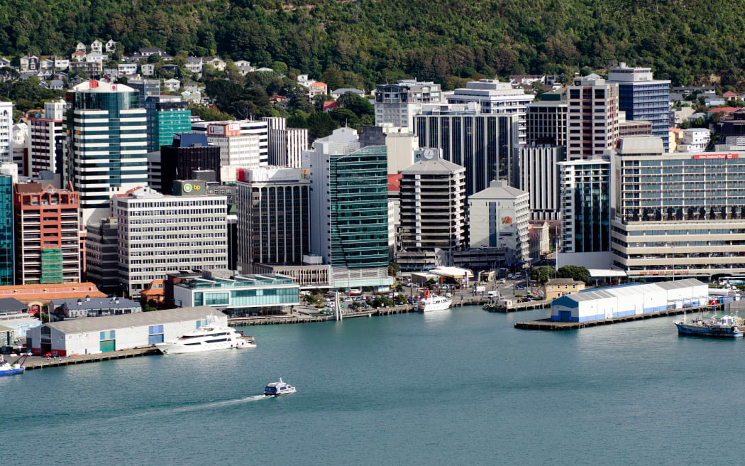
Wellington: Just 18 years or less before serious effects
Dr Naish said he was surprised how soon impacts would be felt in parts of Auckland and Wellington.
Some areas are sinking 3mm or 4mm a year — about the annual rate at which the sea is rising.
“[This] doubles the amount of sea level rise and it halves the time … you thought you had to deal with the sea-level rise that was in the original guidance documents that councils were using.”
Dr Naish described a case study of the road connecting Petone and Eastbourne in Lower Hutt, which would see 30cm of sea level rise by 2040.
This threshold is important because at that level a one-in-100 year storm which closes the roads and damages infrastructure could happen every year.
He said local and regional councils have been making plans for this threshold to be reached in 2060, giving 20 fewer years to plan and adapt accordingly.
Other places on Wellington’s south coast such as Ōwhiro Bay, Lyall Bay, Seatoun among others are also subsiding.
“You are going to see the impacts of quite damaging sea level rise much sooner than we thought …. roads and properties inundated.”
He said road and rail infrastructure on State Highway 2 at the Korokoro interchange in Petone is another highly vulnerable area.
The largest overall increases in the whole country are on the southeast North Island along the Wairarapa Coast.
Here, the sea level could be be up well over one and a half metres by 2100.
About 30cm of sea level rise is unavoidable because of the amount of climate gases already in the atmosphere.
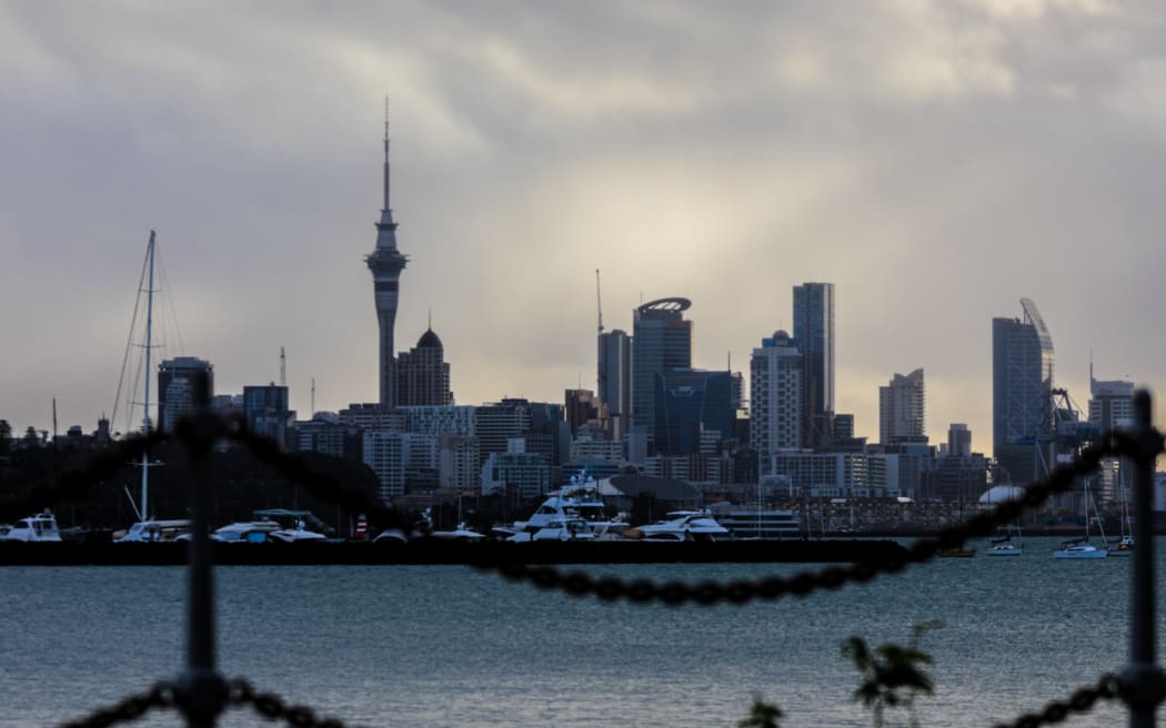
Homes and crucial infrastructure in Auckland in the firing line
Dr Naish said vulnerable places in Auckland included the waterfront around the bays, Tamaki Drive, the Viaduct, areas around the Northwestern Motorway at Point Chevalier, St Heliers and Mission Bay.
He said many of these places already have issues during king tides, are close to sea level, and are sinking.
At the Viaduct the land is sinking about about 2.5mm a year.
“That almost doubles the rate of expected sea-level rise and halves the time you have.
“The city council, [and] the port authority are all going to have to start looking closely in terms of their future activities at this new information.”
He said in many parts of Auckland the sea-level would rise 30 to 50 percent faster than what was previously thought.
Meanwhile, he said parts of Thames township is also very vulnerable, and the sinking happening in the Hauraki plains means the stopbanks there have a shorter lifespan than previously thought.
Richmond in Nelson a hotspot
A major worry is the suburb of Richmond and nearby parts in the Nelson area which is subsiding at about 5mm a year.
“That whole area there has been a lot of development, new subdivisions, housing … the airport is very exposed, and that road around [the coast to Richmond] is vulnerable,” Naish said.
He said local and regional councils in the region have known for a long time there could be issues there with sea-level rise.
“There is going to be some really big challenges for that region.”
Online tool lets residents, authorities check
New Zealanders will soon be able to see for the first time how much and how fast sea-level will rise along their own stretch of coast.
The entire coastline has been mapped down to a 2km spacing.
The new advice combines data about where land is sinking with the latest international sea-level rise projections.
It will be an major new tool for councils, businesses and homeowners to assess risk from erosion and floods.
New data shows that sea levels are rising twice as fast as expected in New Zealand https://t.co/TUj5Vdr4nk
— RNZ News (@rnz_news) May 1, 2022
‘Information is power’
Dr Naish said the new data was important information and people should try not to be too overwhelmed.
“Information is power, so don’t be afraid of it.
“We still have time … but we don’t have time to sit on our hands anymore.
“If you’re a [council representative] or you’re a developer, or you’re a decisions maker in the coastal areas of New Zealand you need to start thinking right now what the plan is for adapting to that sea-level rise.
“Yes, it is a bit terrifying but there is still time and I think that is the way to look at it.”
The information is timely, coming hot on the heels of the climate change draft adaptation plan released last week.
It asks for public input on the plans, and on so-called ”managed retreat’” – abandoning areas where it is not possible or financially viable to live any longer.
Uncertainty about predictions laid out in tool
Dr Naish said uncertainty about the predictions were clearly laid out in the tool — but he said there was no question that there would be a response from property owners, the insurance and banking sectors to the new information.
GNS Science Environment and Climate Theme Leader Dr Richard Levy said until now, the risk from sea-level rise has been quite poorly defined for New Zealand.
“Current sea-level projections in the Ministry for the Environment coastal hazards guidance do not take into account local vertical land movements.”
Most of the information about sea-level rise was more or less extrapolated out from the global average.
NZ SeaRise is a five-year research programme comprising local and international experts from Te Herenga Waka-Victoria University of Wellington, GNS Science, NIWA, University of Otago and the Antarctic Science Platform.
It is funded by the Ministry for Business, Innovation and Employment.
Climate change and warming temperatures are causing sea levels to rise, on average, by 3.5 mm per year.
This sea level rise is caused by thermal expansion of the ocean, by melting land based glaciers, and by melting of the Greenland and Antarctic ice sheets.
This article is republished under a community partnership agreement with RNZ.

Article by AsiaPacificReport.nz