Source: The Conversation (Au and NZ) – By Andrew Dowdy, Principal Research Scientist in Extreme Weather, The University of Melbourne
In media articles about unprecedented flooding, you’ll often come across the statement that for every 1°C of warming, the atmosphere can hold about 7% more moisture.
This figure comes from research undertaken by the French engineer Sadi Carnot and published 200 years ago this year.
We now know there’s more to the story. Yes, a hotter atmosphere has the capacity to hold more moisture. But the condensation of water vapour to make rain droplets releases heat. This, in turn, can fuel stronger convection in thunderstorms, which can then dump substantially more rain.
This means that the intensity of extreme rainfall could increase by much more than 7% per degree of warming. What we’re seeing is that thunderstorms can likely dump about double or triple that rate – around 14–21% more rain for each degree of warming.
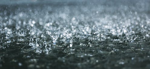
Thunderstorms are a major cause of extreme flooding around the world, contributing to Brazil’s disastrous floods, which have submerged hundreds of towns, and Dubai’s flooded airport and roads.
For Australia, we helped develop a comprehensive review of the latest climate science to guide preparedness for future floods. This showed the increase per degree of global warming was about 7–28% for hourly or shorter duration extreme rain, and 2–15% for daily or longer extreme rain. This is much higher than figures in the existing flood planning standards recommending a general increase of 5% per degree of warming.
Why are thunderstorms important for extreme rain?
For thunderstorms to form, you need ingredients such as moisture in the air and a large temperature difference between lower and higher air masses to create instability.
We typically associate thunderstorms with intense localised rain over a short period. What we’re seeing now, though, is a shift towards more intense thunderstorm downpours, particularly for short periods.
Extreme rain events are also more likely when thunderstorms form in combination with other weather systems, such as east coast lows, intense low pressure systems near eastern Australia. The record floods which hit Lismore in February 2022 and claimed the lives of many people came from extreme rain over many days, which came in part from severe thunderstorms in combination with an east coast low.
Climate change pumps up extreme flood risk factors
The latest report from the Intergovernmental Panel on Climate Change (IPCC) states that:
frequency and intensity of heavy precipitation events have increased since the 1950s over most land areas for which observational data are sufficient for trend analysis (high confidence), and human-induced climate change is likely the main driver
This increase is particularly clear in short-duration extreme rains, such as those caused by thunderstorms.
Why? In part, it’s because of the 7% figure – warmer air is able to hold more water vapour.
But that doesn’t explain everything. There’s something else going on. Condensation produces heat. So as water vapour turns into droplets, more heat becomes available, and hot air rises by convection. In thunderstorms, more heat fuels stronger convection, where warm, moisture-laden air is driven up high.
This explains why thunderstorms can now drive such extreme rainfall in our warming world. As water vapour condenses to make rain, it also makes heat, supercharging storms.
We are seeing these very rapid rates of rainfall increase in recent decades in Australia.
Daily rainfall associated with thunderstorms has increased much more than the 7% figure would suggest – about 2-3 times more.
Hourly rainfall extremes have also increased in intensity at similar rates.
What about very sudden, extreme rains? Here, the rate of increase could potentially be even larger. One recent study examined extreme rain for periods shorter than one hour near Sydney, suggesting about a 40% increase or more over the past 20 years.
Rapid trends in extreme rainfall intensity are also clear in other lines of evidence, such as fine-resolution modelling.
To model complex climate systems, we need the grunt of supercomputers. But even so, many of our models for climate projections don’t drill down to grid resolutions smaller than about 100 kilometres.
While this can work well for large-scale climate modelling, it’s not suitable for directly simulating thunderstorms. That’s because the convection processes needed to make thunderstorms form happen on much smaller scales than this.
There’s now a concerted effort underway to perform more model simulations at very fine scales, so we can improve the modelling of convection.
Recent results from these very fine scale models for Europe suggest convection will play a more important role in triggering extreme rainfall including in combined storms, such as thunderstorms mingling with low pressure systems and other combinations.
This matches Australian observations, with a trend towards increased rain from thunderstorms combining with other storm types such as cold fronts and cyclones (including low-pressure systems in southern Australia).

Leah-Anne Thompson/Shutterstock
Does this change how we plan for floods?
The evidence for supercharged thunderstorm rainfall has grown in recent years.
Australia’s current flood guidance recommendations, which influence how infrastructure projects have been built, are based on extreme rain increasing by just 5% for each degree of warming.
Our research review has shown the real figure is substantially higher.
This means roads, bridges, tunnels built for the 5% figure may not be ready to deal with extreme rain we are already seeing from supercharged thunderstorms.
While Australia has become more conscious of links between climate change and bushfires, studies show we are less likely to link climate change and more intense storms and floods.
This will have to change. We still face some uncertainties in precisely linking climate change to a single extreme rain event. But the bigger picture is now very clear: a hotter world is likely one with higher risk of extreme floods, often driven by extreme rain from supercharged thunderstorms.
So what should we do? The first step is to take climate change influences on storms and flood risk as seriously as we now do for bushfires.
The next is to embed the best available evidence in how we plan for these future storms and floods.
We have already loaded the dice for more extreme floods, due to existing human-caused climate change and more to come, unless we can quickly reduce our greenhouse gas emissions.
Read more:
Why is Australia’s east coast copping all this rain right now? An atmospheric scientist explains
![]()
Andrew Dowdy receives research funding from The University of Melbourne.
Conrad Wasko receives funding from the Australian Research Council.
Jennifer Catto is an Associate Professor of Weather and Climate at the University of Exeter and receives funding from various research councils.
Seth Westra is a Professor of Climate Risk an the University of Adelaide, Research Director of the One Basin Cooperative Research Centre, and Director of the Systems Cooperative. He receives funding from various government and non-government sources.
– ref. Supercharged thunderstorms: have we underestimated how climate change drives extreme rain and floods? – https://theconversation.com/supercharged-thunderstorms-have-we-underestimated-how-climate-change-drives-extreme-rain-and-floods-228896