

Source: The Conversation – Canada
In the past 30 years, floods have affected more than 2.8 billion people worldwide and caused over 500,000 deaths. In Canada, flooding has caused significant damage and disruption to communities across the country. The 2021 floods in British Columbia’s Fraser Valley cost an estimated $14 billion in damages.
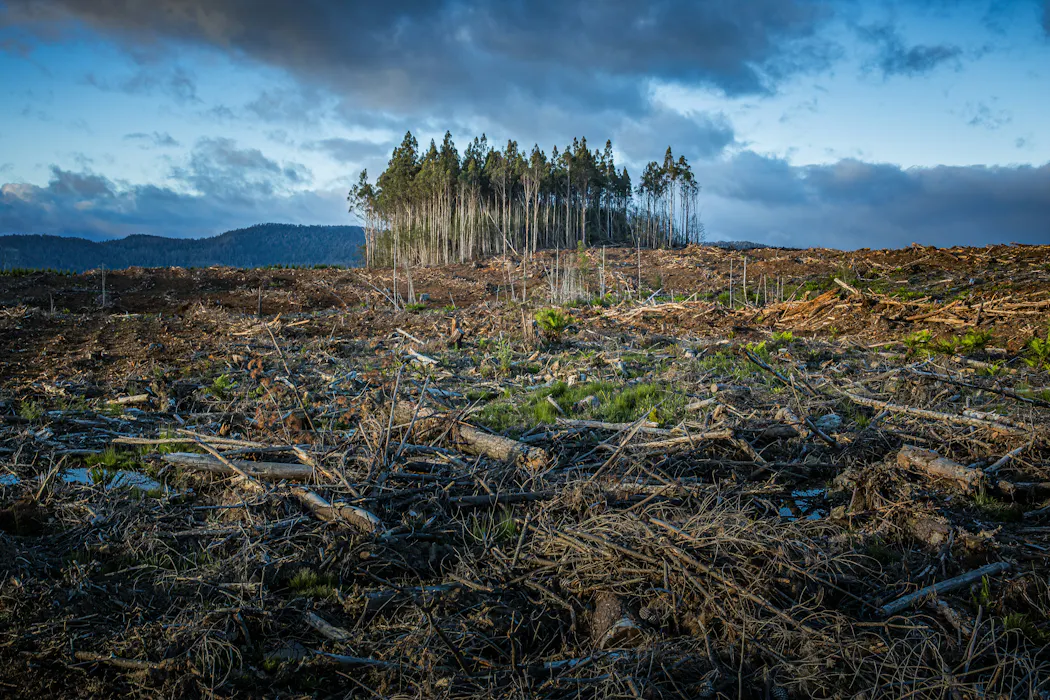
Human activity that changes landscapes can make floods larger and more frequent. Our recently published study shows that clear-cut logging can dramatically increase flood risk, turning what was once a 50-year event into a flood recurring every three years, with the largest and rarest floods showing the greatest sensitivity to forest disturbance.
We studied a watershed on the west shore of Lake Okanagan near Summerland, British Columbia. Around 40 per cent of the site experienced logging. This watershed is no exception, as B.C.’s landscape has become dominated by clear-cut logging.
We found that, without logging, flood risk due to reduced snow melt was decreasing. But after logging, this was reversed, leading to significant upward trend in flood risk.
Flooding has become more frequent across B.C., leading to exorbitant costs to taxpayers. In order to address these challenges, it is critical that the drivers affecting flood risk are clearly understood.
Understanding the relationship between human actions across the landscape and their associated risks is critical to making informed decisions that can mitigate risk, and lower costs passed on to the public.
More frequent and larger floods

(Peter Robbins/Unsplash)
In mountainous environments where floods are driven by melting snow, logging can change the timing of the snow melt. Additionally, logging causes larger snow packs, which can melt faster without shading from the trees. Generally, when the forest harvesting leads to synchronization in the timing of snow melt, flood risk increases.
A common finding in scientific and government reports is that small- to medium-sized floods are impacted by logging, while larger floods are not. Our study found the opposite. In other words, the largest, rarest floods are the most affected by logging.
This phenomenon can be largely explained by the landscape at the study site, and the distribution of logging across it. The area has dominantly south- and southeast-facing slopes, and logging occurs within mid- to high-elevation areas. The aspect and elevation of the locations logged across the landscape are what led to such dramatic changes in flood risk.
In our study, we found that a once 20-year flood now recurs every two years. Another study in Colorado found that after the same amount of logging (40 per cent of the area), floods recurring every 20 years started recurring every 12 years.
The ability of the forests to mitigate or heighten flood risk depends greatly on how logging takes place across an area. Where trees are removed is often more important than the number taken.
Climate change and logging
One of the advantages of our study is that it allowed us to disentangle the effects of climate change from logging on flood risk. Our results go against a common narrative that climate change is increasing flood risk in B.C. While climate change does play a role in the risk of flooding, we must also pay attention to other factors, like logging.
In our study, we found climate change is causing a reduction in flood risk due to reduced snowpack in the area. However, logging is not just compensating for that reduction, it’s also increasing the overall flood risk in the watershed. This story is likely not unique given that climate change is reducing snowpack cover across southern B.C. as well as the central interior of the province.
Without having a way to distinguish between the various drivers of flood risk, our results would have shown a smaller impact from logging due to the declining flood risk caused by climate change.
Despite the well-documented notion that climate change is affecting flood risk, one of the dominant flood prediction frameworks in professional practice, flood frequency analysis, assumes that climatic factors remain constant over time.
In research investigating the impacts of logging on flood risk, the same assumption is often made. This limitation is what led us to develop this methodology disentangling the factors influencing flood risk.
Legal liabilities, public assessments
The legal liability associated with logging and floods is significant. Communities have launched class-action suits against governments and the forest industry. To avoid such lawsuits, companies and governments must take greater care in forestry planning to avoid passing unintended disaster costs on to the public.
The best way to cut trees without increasing flooding risk will differ across watersheds. Our paper highlights that the way cut areas are distributed across the landscape determines impact on flood risk, rather than the total number of trees felled or areas logged. With the right decision-making, it’s possible to mitigate the flood risk in some cases.
As of now, watershed assessments conducted by professionals prior to forestry operations are not publicly available in most cases, and often aren’t required in the first place. B.C. needs stronger, legally enforceable accounting of the risks before an area is logged.
These assessments should be publicly available and completed by qualified and independent professionals. Without governments and industry accounting for risks, the costs of forestry-related flooding will fall onto residents, First Nations, governments and taxpayers.

The authors do not work for, consult, own shares in or receive funding from any company or organisation that would benefit from this article, and have disclosed no relevant affiliations beyond their academic appointment.
Original source: https://analysis1.mil-osi.com/2026/07/06/new-study-finds-clear-cut-logging-can-dramatically-increase-flood-risk/