Source: The Conversation (Au and NZ) – By Michael Grose, Climate projections scientist, CSIRO

Shutterstock
It’s an offhand joke a lot of us make – it’s freezing, can we get a bit more of that global warming right about now?
But how should we really conceive our day-to-day weather in the context of climate change, especially when Australia’s east coast is enduring a colder-than-normal start to winter? Here are four ways.
Read more:
Why is it so cold right now? And how long will it last? A climate scientist explains
1. Put the weather in a long-term context
The recent cold conditions in some parts of Australia haven’t been seen in decades, but they aren’t unprecedented. In Melbourne, for instance, the first two weeks of June were coldest since 1949. In Brisbane, they were the coldest since 1990.
Under the global warming trend, cold events such as these are becoming less and less likely. But Australia naturally has a variable climate, which means they, of course, still do occur.
And given Australia’s instrumental records go back only 112 years (a relatively short length of time), it’s actually still possible we’ll see new record cold temperatures, even in a warming climate.
Still, record hot temperatures in Australia are being broken 12 times more often than cold ones.
The climate would need to be warming incredibly fast for there to be zero cold records broken, and even faster still if we were to see no cold weather at all. No one suggests this is the reality.
2. Zoom out for a wider view
Let’s look at an individual day – say, Tuesday June 13 – using Climate Reanalyser, a platform for visualising climate and weather datasets.
That day was certainly colder than the 1979-2000 average in eastern Australia and Tasmania. But it was warmer than average in parts of Western Australia and many places around the world, including large parts of Africa. Meanwhile, parts of the United States and Europe were experiencing major heatwaves.
On this day, the global average was 0.3℃ warmer than the 1979-2000 baseline, and this baseline was around 0.6℃ warmer than the pre-industrial climate.
This is exactly what you expect from weather variability in a warming climate – variations day to day and place to place, but a consistently warmer climate when you take the wide view.

Manu Fernandez/AP
3. Look at the climate indicators with more ‘memory’
Looking at the weather day to day is a bit like watching the live share market updates from one stock exchange. To understand the trends and the bigger picture, you need to track it over time and space.
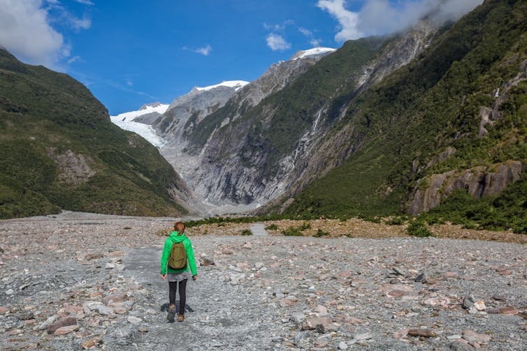
Given instrumental records only go back so far, scientists can use climate indicators found in nature. Glaciers, for example, respond to temperature over time, with almost all glaciers around the world receding in response to a warmer climate.

Shutterstock
The oceans have longer memories than the atmosphere. Ocean warming is clear in, for instance, the East Australian Current, which now extends further south, bringing warmer water down the southeast coast. This, in turn, is driving fish species further south and devastating kelp forests.
Perhaps the most reliable indicator of warming planet is the total “ocean heat content” – the total amount of extra energy stored in our oceans, which can store a lot more than the atmosphere. There has been a rock-steady increase of ocean heat content in recent decades.
Read more:
How climate change made the melting of New Zealand’s glaciers 10 times more likely
4. Consider the concept of attribution
Determining whether climate change helped make a particular weather event more likely or more severe than it would have been – whether a cold snap, a heatwave or flooding rains – requires a formal attribution study, which looks for a climate change “fingerprint”.
Overall, the planet has warmed 1.09℃ since pre-industrial times. And since 2012, the human caused climate change fingerprint has been clear in any single day of global weather.
Thanks to event attribution studies, we can confidently state that cold extremes are now less likely than they would be in a world without climate change, while heatwaves and extreme heat events are far more likely.
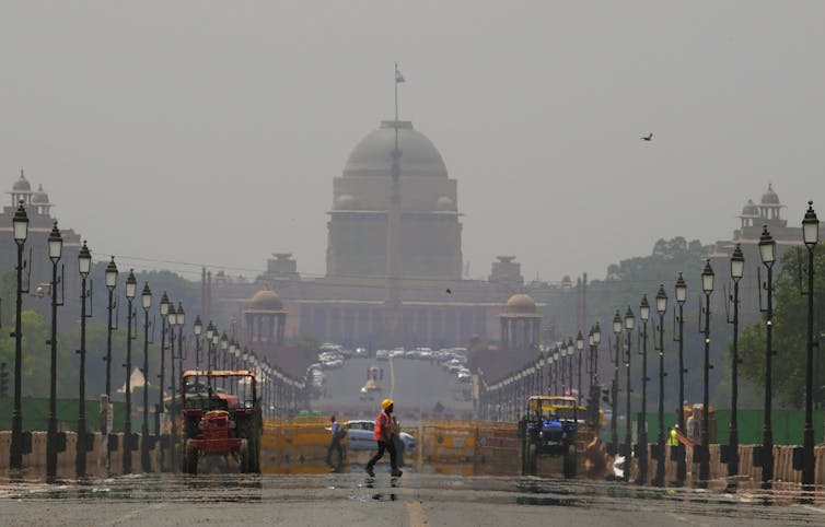
For example, climate change made the recent devastating heatwave in India and Pakistan 30 times more likely.

AP Photo/Manish Swarup
Our weather intuitions
Our intuitions and common sense are great tools for navigating our day-to-day life and making decisions. But our first-hand experience is rooted at the scale of centimetres to kilometres, seconds to days.
Our brains are not perfect data loggers over decades, and our memories are subjective. Vivid childhood memories of hot asphalt on our young feet, cars with hot vinyl seats and houses with no air conditioners affect how we compare the past to today. And we aren’t exposed to all weather, especially us city dwellers who spend a lot of time indoors.
Pulling at our intuitions about cold weather to comment about climate change can be compelling. United States senator James Inhofe famously brought a snowball into the senate in 2015 to claim that if there’s cold weather then the climate can’t be warming.
While this was widely mocked at the time, these appeals do tug at our instincts to turn to our experiences to understand the world.
To get out of these local scales, we need to feed our intuitions some more input. So, data are important.
With data, we can inform and guide our intuitions and overcome our natural focus on the local scale. To be convinced the climate is warming, we need to watch the long-term trends and expect the wiggles.
And just like in places such as southern Australia where the climate is drying, we still expect some wet years, we still expect cold spells in a warming climate.
It is instinctual to downplay or doubt the idea the climate is getting warmer when you’re feeling cold right now. But next time, consider these four points.
![]()
Michael Grose receives funding from the National Environmental Science Program.
– ref. 4 ways to understand why Australia is so cold right now despite global warming – https://theconversation.com/4-ways-to-understand-why-australia-is-so-cold-right-now-despite-global-warming-184834


