Source: The Conversation (Au and NZ) – By Jonathan Nott, Professor of Physical Geography, James Cook University

Shutterstock
We’ve long known cyclones are heat engines, fuelled by hot water. They also pump heat from the hot tropics into cooler areas. But they’re starting to behave differently. As the world heats up, the atmosphere can hold more moisture. When cyclones form, they can transfer significantly more water from oceans to land.
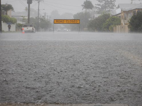
We saw this in December. Most of the damage done by Cyclone Jasper when it hit far north Queensland wasn’t from the intense winds. It was when the Category 2 storm stalled over Cape York, dumping huge amounts of rain – over 2 metres in some areas – and triggering devastating floods.
It’s likely to happen again this week, as a slow-moving tropical low heads for northern Queensland, carrying huge volumes of water and threatening new floods. Authorities are warning people to prepare – not just on the coast but well inland.
The storm – likely to be named Cyclone Kirrily – will be the second to make landfall this season.

Bureau of Meteorology, CC BY-ND
Cyclone Kirrily: Prepare for floods as well as winds
The tropical storm has taken a long time to intensify and is moving very slowly. While it hasn’t yet reached cyclone status, it is expected to make landfall as a Category 2 storm.
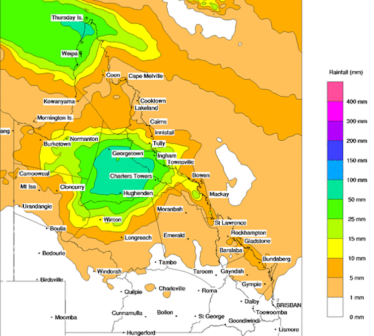
What it is carrying, though, is water – enough to dump up to a metre of rain in some places, and a long way into central and western Queensland.
If you live in northern Australia, you’ll know about being prepared for cyclones. When a warning arrives, people pack away or tie down loose objects, trim tree branches and fill up the bathtub in case water supplies are disrupted.
But often, we’re focused just on the damaging winds – when water can often do more damage.
If you live close to the sea, the storm surge – flooding from the sea – is often underestimated as a threat.
But the new major threat is terrestrial flooding. We are already starting to see significantly more rainfall linked to cyclones. Warmer air holds more moisture, and the world is steadily heating up.
This summer, sea surface temperatures have been unusually high off the east coast, all the way from Cape York down to Tasmania. Normally, in El Niño, we would expect lower sea surface temperatures and higher air temperatures. But this El Niño isn’t behaving as we’d normally expect. That’s one reason the east coast has had so much summer rain.
Normally, 75% of Australia’s cyclones hit the northwest of Western Australia, due to the high sea surface temperatures and the way the coast is oriented. But this year, the northwest region is sweltering in heatwaves – but no cyclones have yet made landfall.
The future has fewer cyclones, but more intense
Climate change is expected to change tropical cyclone patterns. The overall number is expected to decrease, but their intensity will likely increase, bringing stronger wind and heavier rain.
My colleagues and I have found the change is already happening. The low levels of storm activity on the mid west and northeast coasts of Australia are unprecedented over the past 550 to 1,500 years.
More intense tropical cyclones are expected because higher sea-surface temperatures will make the atmosphere more warm and moist. Cyclones thrive in such conditions.
But the general frequency of tropical cyclones is expected to reduce under climate change in most ocean basins, including the Indian Ocean.
Tropical cyclones usually form when there’s a large difference between temperatures at Earth’s surface and the upper atmosphere. As the climate warms, this temperature difference is likely to narrow.
As the heat in the oceans intensifies, cyclones will be able to form further down the east coast. Cyclones have hit Brisbane and even northern New South Wales in the past. These tropical storms form over warm water – between 26.5 and 30°C. The water along Kirrily’s track is at the higher end – around 30°C. Warm water produces warm, moist air, which is the energy-dense feedstock of cyclones.
What should we do to prepare?
In states such as Queensland, emergency response is a finely honed art. We’re excellent at dealing with the emergency when it’s happening and the immediate aftermath.
But we’ve still got a long way to go in mitigation. Houses are still being built in the path of flooding rivers or where they can be hit by storm surge.
Read more:
Anatomy of monster storm: how Cyclone Ilsa is shaping up to devastate the WA coast
![]()
Jonathan Nott does not work for, consult, own shares in or receive funding from any company or organisation that would benefit from this article, and has disclosed no relevant affiliations beyond their academic appointment.
– ref. As another cyclone heads for Queensland, we must be ready for the new threat: torrential rain and floods – https://theconversation.com/as-another-cyclone-heads-for-queensland-we-must-be-ready-for-the-new-threat-torrential-rain-and-floods-221737


